Published
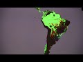
Twelve years of global deforestation, wildfires, windstorms, insect infestations and more are captured in a new set of forest disturbance maps created from billions of pixels acquired by the imager on the NASA-USGS Landsat 7 satellite. The maps are the first to measure forest loss and gain using a consistent method around the globe at high spatial resolution, allowing scientists to compare forest changes in different countries and to monitor annual deforestation. Since each pixel in a Landsat image represents a piece of land about the size of a baseball diamond, researchers can see enough detail to tell local, regional and global stories.
Key to the project was collaboration with team members from Google Earth Engine, who reproduced in the Google Cloud the models developed at the University of Maryland for processing and characterizing the Landsat data. The computing required to generate these maps would have taken 15 years on a single desktop computer, but with cloud computing was performed in a few days.
Since 1972, the Landsat program has played a critical role in monitoring, understanding and managing the resources needed to sustain human life such as food, water and forests. Landsat 8 launched Feb. 11, 2013, and is jointly managed by NASA and USGS to continue the 40-plus years of Earth observations.
To view the forest cover maps in Google Earth Engine, visit:
To learn more about Landsat, visit: or
This video is public domain and can be downloaded at:
Like our videos? Subscribe to NASA's Goddard Shorts HD podcast:
Or find NASA Goddard Space Flight Center on facebook:
Or find us on Twitter:
- Category
- Social
Be the first to comment
Up Next
Autoplay
-
03:59

New Site Maps Reports of Sexual Harassment in Egypt
-
01:32
NASA | Aquarius Returns Global Maps of Soil Moisture
-
01:57
NASA | Landsat Looks to the Moon
-
03:06
NASA's Laser Mission to Measure Trees
-
01:42
Landsat: Farming Data From Space
-
06:10
NASA | Landsat Helps Feed the Birds
-
01:21
Apple Maps The Shining Parody Movie HD
-
15:24
The Meaning of Maps: Jeffrey McMurtrie at TEDxAlgonquinPar
-
16:37
Aris Venetikidis: Making sense of maps
-
01:20
The Stig Vs. Google Maps Car - Top Gear Track now available on Google Maps!
-
03:11
NASA | Landsat Tracks Urban Change and Flood Risk
-
01:31
Landsat Celebrates 45 Years of Earth Observations
-
00:52
Landsat's Global View of Ice Velocity
-
01:19
Landsat Tracks Mount St. Helens Recovery
-
00:58
‘fall over’, ‘fall off’, ‘fall down’ – what’s the difference? #shorts
-
01:33
Apple Maps Dark Knight Parody Movie HD
-
01:16
NASA | Landsat's Orbit
-
02:11
NASA's Black Marble Maps Puerto Rico's Energy Use After Hurricane Maria
-
07:36
NASA | Landsat's Global Perspective
-
03:11
NASA | Landsat 8 Celebrates First Year in Orbit
-
02:57
NASA | Peeling Back Landsat's Layers of Data
-
00:52
Landsat's Global View of Ice Velocity
-
01:23
Apple Maps Hunger Games Parody Movie HD
-
02:59
Joe Jonas Watches Himself Fall, Fall and Fall Again