Published
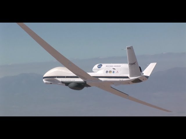
NASA scientist Bryan Blair introduces a laser mapping sensor known as LVIS (the Land, Vegetation, and Ice Sensor), which is flown by aircraft over target areas to collect data on surface topography and vegetation cover. Bryan also discusses the benefits to mounting LVIS onto high-altitude, long-duration aircraft such as the Global Hawk drone.
This video is public domain and can be downloaded at:
Like our videos? Subscribe to NASA's Goddard Shorts HD podcast:
Or find NASA Goddard Space Flight Center on facebook:
Or find us on Twitter:
This video is public domain and can be downloaded at:
Like our videos? Subscribe to NASA's Goddard Shorts HD podcast:
Or find NASA Goddard Space Flight Center on facebook:
Or find us on Twitter:
Be the first to comment
Up Next
Autoplay
-
01:19

Mapping Carbon in 3-D
-
00:51
NASA Space Laser Heads on a Road Trip
-
03:50
OSIRIS-REx Tech: Mapping an Asteroid with Lasers
-
07:05
Mapping the Stories of a City: Sarah Lawrence at TEDxUGA
-
03:27
NASA | Mapping Mars' Upper Atmosphere
-
03:42
NuFormer - 3D Video Mapping Projection on Buildings
-
1:07:22
FULL INTERVIEW: Triple H on mapping The Road to WrestleMania 41, his career journey
-
01:02
Oskar and Gaspar Shed Light On Their 3D Projection Mapping Performance - America’s Got Talent 2017
-
00:49
What is Empathy Mapping ?
-
01:04
Mapping in the Cloud with Rapyuta
-
04:11
NASA Views Laser Landscapes of Helheim Glacier
-
02:59
NASA | Laser Focus
-
22:28
National Geographic Live! - Mapping The Brain
-
14:42
National Geographic Live! - Mapping The Unknown, Part 1: Kenny Broad And Blue Holes
-
04:03
Mapping the Way to a Better Soybean
-
03:06
NASA's Laser Mission to Measure Trees
-
01:41
NASA Celebrates Earth Day and the Amazing Tech that Makes Earth Exploration Possible
-
02:01
Cloud-based Collaborative 3D Mapping in Real-Time with Low-Cost Robots
-
16:18
Body Mapping - How We See Our Health: Michelle Kwan at TEDxRyersonU
-
06:15
Archeology from Space: Mapping Tombs with Satellites
-
07:43
NASA | MAVEN: NASA's Next Mission to Mars
-
00:54
NASA | Mapping Alaska's Forests
-
03:24
NASA | Laser Focus: The Receiver
-
48:45
The Matrix of Control→ Silent Weapons For Quiet Wars - DARPA - Agenda 21 - DNA Mapping