Published
The Ice, Cloud and land Elevation Satellite-2 is slated to launch in September to measure the height of Earth’s surface, particularly the changing polar ice. To do that, it uses a laser instrument called the Advanced Topographic Laser Altimeter System, or ATLAS, that precisely times how long it takes light particles to bounce off Earth and return to the satellite.
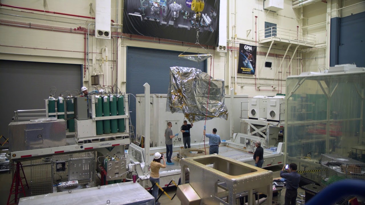
ATLAS was designed, built and tested at NASA’s Goddard Space Flight Center in Greenbelt, Maryland. The spacecraft bus, with its solar panels, navigation components and more, was built at Orbital ATK’s facility in Gilbert, Arizona. To deliver the instrument safely to the spacecraft for assembly and testing, the ATLAS team developed special procedures for packing, transporting and monitoring the sensitive hardware.
Read more:
This video is public domain and along with other supporting visualizations can be downloaded from the Scientific Visualization Studio at:
Credit: NASA's Goddard Space Flight Center/Ryan Fitzgibbons
Music: "We Learn," Andrew Michael Britton, Atmosphere Music Ltd.
If you liked this video, subscribe to the NASA Goddard YouTube channel:
Follow NASA’s Goddard Space Flight Center
· Facebook:
· Twitter
· Flickr
· Instagram
· Google+ ...
ATLAS was designed, built and tested at NASA’s Goddard Space Flight Center in Greenbelt, Maryland. The spacecraft bus, with its solar panels, navigation components and more, was built at Orbital ATK’s facility in Gilbert, Arizona. To deliver the instrument safely to the spacecraft for assembly and testing, the ATLAS team developed special procedures for packing, transporting and monitoring the sensitive hardware.
Read more:
This video is public domain and along with other supporting visualizations can be downloaded from the Scientific Visualization Studio at:
Credit: NASA's Goddard Space Flight Center/Ryan Fitzgibbons
Music: "We Learn," Andrew Michael Britton, Atmosphere Music Ltd.
If you liked this video, subscribe to the NASA Goddard YouTube channel:
Follow NASA’s Goddard Space Flight Center
· Facebook:
· Flickr
· Google+ ...
- Category
- Documentary
- Tags
- NASA
Be the first to comment
Up Next
Autoplay
-
02:58

NASA | Laser Mapping The Earth
-
01:58
How NASA Studies The Space Near Earth
-
03:11
Smartphones in Space: a Really Long-Distance Call for NASA
-
01:10
NASA'S NICER Does the Space Station Twist
-
00:53
NASA's CAMP2Ex Heads to the Philippines for Monsoon Season
-
01:39
NASA | Tracking Space Weather for New Horizons
-
05:33
How NASA Will Protect Astronauts From Space Radiation
-
02:50
NASA | CATS in Space Keep Eyes on Atmosphere
-
03:24
NASA | Laser Focus: The Receiver
-
02:59
NASA | Laser Focus
-
02:39
NASA | IceBridge Heads for the Coast
-
03:23
Dinosaur Age Meets the Space Age at NASA Goddard
-
03:37
NASA Follows Changing Freshwater from Space
-
01:13
James Webb Space Telescope Laser-Focused Sight
-
26:25
Phoenix to Moab to Denver: First On and Off-Road New Wrangler Road Trip Review
-
04:29
NASA | NASA Sees Holiday Lights from Space
-
04:11
NASA Views Laser Landscapes of Helheim Glacier
-
05:23
NASA | Highlights from SOHO's 20 Years in Space
-
03:35
NASA | Tracking Agricultural Water Use From Space
-
01:41
NASA | Brazil’s Extreme Drought Seen From Space
-
11:18
MY SCHOOL FIELD TRIP GONE WRONG. Road Trip Horror Story
-
03:06
NASA's Laser Mission to Measure Trees
-
00:33
NASA Satellites See Wildfires from Space
-
03:05
NASA | GOES-R: Living with Space Weather